FUGRO GEOTECH INDIA P. LTD.
Featured Products
Highest quality standards are achieved through the implementations of latest technology, decades of experience and everlasting moral values , which have helped us to retain our customers as well as multiply them.
Welcome to FUGRO GEOTECH INDIA P. LTD.
Marine Geoconsulting
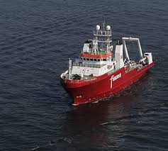
GEOHAZARD STUDIES
Our complete geohazard assessment service covers hazard identification, risk assessment, analysis, solution engineering and management.
OFFSHORE EXPLORATION ACTIVITIES
Specialist advice to optimise prospect evaluation and drilling operations supporting efficient management of your exploration budget.
OFFSHORE GEOTECHNICAL ENGINEERING
Geotechnical engineering design solutions for problems associated with onshore and nearshore projects including foundations, excavations, embankments and ground improvement.
Marine Geotechnical
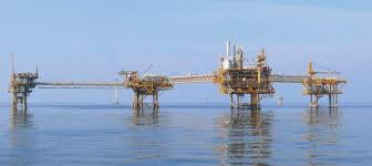
We provide marine geotechnical services to determine and manage the ground risk associated with marine project development. Using technical expertise, advanced exploration tools, field and laboratory testing, computer simulations and quantitative methods, we identify, evaluate and resolve your geotechnical design challenges.
OFFSHORE GEOTECHNICAL SITE INVESTIGATIONS
As the largest global supplier of marine geotechnical services, we provide the full range of geotechnical site investigation services in water depths ranging from a few meters to more than 3,000 meters.
OFFSHORE GEOTECHNICAL ENGINEERING
Our engineers apply their skills together with advanced software tools to provide services associated with the design of offshore structures and foundations.
MARINE INSTALLATION SERVICES
We have extensive in-house design and fabrication capabilities for speciality nearshore drilled foundation installation, shaft construction, and associated installations in challenging marine environments.
GAS HYDRATE INVESTIGATIONS
We apply our extensive experience in offshore site investigations to the design and execution of gas hydrate investigation programmes.
HYDROCARBON SEEP HUNTING
Our seep hunting and geochemical campaigns are an innovative method for economical and effective exploration, especially in frontier regions where prospectivity is uncertain.
DRILLING AND WELL SERVICES
Our range of drilling and subsea well services supports the world’s oil and gas operators in reducing risk at well sites.
Geophysical Surveys
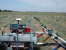
Fugro supports your offshore development activities with survey services in all water depths. We perform surveys of rig sites and pipeline routes; and for engineering developments our surveys reduce project risk, enhance safety and facilitate route and project design for offshore developers.
Our surveys can assist in the design and execution stages prior to rig moves and the emplacement of offshore infrastructure such as hydrocarbon production facilities, pipeline routes, offshore wind farms and other civil engineering projects. Utilising survey vessels from our global fleet, many of which are purpose-built and designed for efficient and integrated operations, we acquire multi-disciplinary and complimentary data sets in a single mobilisation.
Innovative techniques enable multiple sensors to be operated simultaneously, further enhancing efficiency.
Our range of services includes:
Rig and platform site surveys
Geohazard surveys
Wind farm site surveys
Pre-engineering surveys
Clearance surveys including UXO
Ice gouge surveys
Multibeam echosounder surveys in shallow and deep water
Pipeline route surveys
Deepwater site developments
LNG and FPSO offloading facilities
Marine archaeology
Metocean Surveys
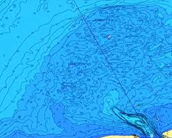
A good understanding of meteorological and oceanographic (metocean) conditions reduces uncertainty in engineering specifications, provides help in operational planning, leads to reduced costs, and enhances safety and operational efficiency. We provide commercial metocean services and systems on a fully integrated world-wide basis to meet and support your needs in offshore and coastal environments.
The provision of high quality regional oceanographic and meteorological (metocean) data is the first step in the development of any offshore, coastal engineering or renewable energy project. With over 30 years’ experience in a diversity of projects, we are well placed to respond to your metocean needs, providing solutions through cost-effective, high quality and technically advanced measurement, consultancy, information systems, ocean observing systems and forecasting services.
The expertise, experience and skills of our staff, enable us to bridge the gap between the scientific and engineering disciplines and to understand and fulfil your engineering requirements.
The broad spectrum of metocean services and systems we offer includes:
Metocean measurement services
Metocean criteria, desk studies and numerical modelling
Real-time environmental monitoring systems
Integrated real-time buoy monitoring systems
Meteorological & oceanographic forecasting services
Data analysis and data management
Marine Environmental Services
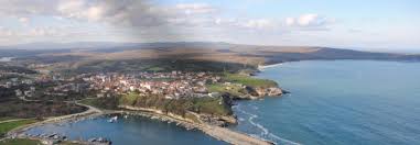
Fugro’s comprehensive marine environmental services integrate consultancy with ecological surveys and laboratory testing. Focused on coastal, marine and estuarine environments, these services support infrastructure planning, consenting and development, environmental protection and resource management.
For a complete project management solution we provide a combination of marine planning, project management, data acquisition, survey, analysis and consultancy services. These capabilities are also available individually.
Expert marine environmental advice and support is critical to the development of any offshore project and dedicated research is required to assess potential impacts on the marine environment.
With active cooperation between our specialists, we integrate our services enabling you to realise cost savings throughout your project. We work closely with other stakeholders to ensure that the project lifecycle is a positive experience for every party involved.
We aim for excellence and continually seek to improve our service; we do this through innovation, by integrating new technological advances and challenging processes and ideas. With dedicated specialists and ongoing research programmes, we manage challenging projects and provide expert advice.
Employing staff with in-depth knowledge of diverse market sectors, including renewable energy, oil and gas, aggregates, ports and harbours, cables and pipelines, leisure, the public sector and water industries
Hydrographic Survey Services
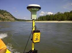
Fugro’s survey fleet is equipped with full ocean depth multibeam echosounder systems for habitat surveys, hydrographic surveys and charting. Our accurate desktop studies assist in cable route planning and for cable burial we conduct onboard soils assessment. Our services also include airborne acquisition of bathymetric lidar data and the acquisition of 2D seismic data for Exclusive Economic Zone assessment for UNCLOS claims.
For submarine communication and power cables we provide planning, desk top studies, site visits, route selection, route survey and installation support. Associated services include environmental impact studies, burial assessment surveys and archaeological surveys.
Airborne Lidar Bathymetry (ALB) and terrestrial laser scanning offer highly efficient and cost-effective solutions to hydrographic surveying, riverine mapping, coastal zone and engineering projects. Our BOAT-MAP technique combines the benefits of multibeam bathymetry with above-water laser scanning to produce a seamless image of the coastal zone, both above and below the water line. Habitat and reef mapping are amongst the features of our environmental services.
For UNCLOS claims, our EEZ mapping services include bathymetry and seismic data acquisition as well as expert advice on maritime boundaries and workshops and seminars tailored to your specific requirements. Our range of services includes:
Airborne Lidar Bathymetry (ALB)
Cable route surveys
Burial assessment
Desk top studies
Global ‘Law of the Sea’ services
Fisheries habitat
Hydrographic mapping
Support for engineering projects
Hazard surveys
Underwater infrastructure inspection
Our Vision
* To embrace new technologies and methods. * To give unsurpassed products and services to the clients. * To constantly look for improvement and changes.


